
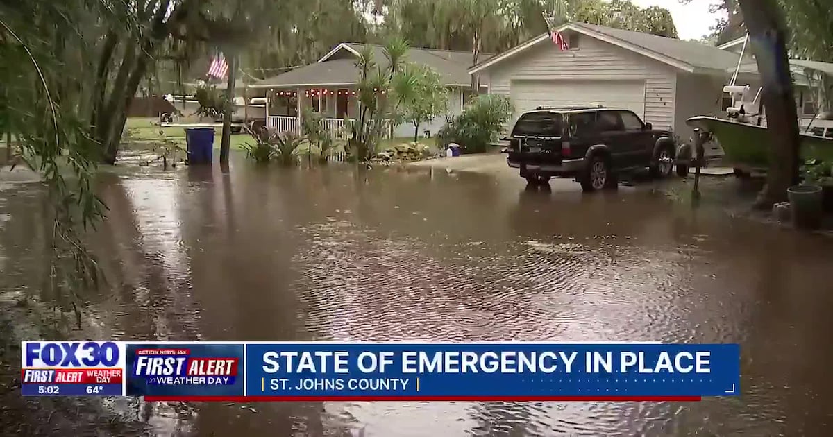
St. Johns County, Florida, is under a state of emergency after days of relentless rainfall sent rivers surging past historic records and left streets and neighborhoods inundated. Local authorities issued the emergency declaration on November 20, 2026, warning that continued heavy rain could bring an additional 2 to 6 inches and urging residents to prepare for hazardous conditions.
The National Weather Service forecasts that, through at least November 21, total rainfall in the area could reach up to 12 inches in isolated spots. Flooded driveways, yards, and major roadways have disrupted normal life across the county, while some neighborhoods face accessibility challenges due to high water.
“We are monitoring the situation hour by hour,” county officials stated, as they activated the Emergency Operations Center to coordinate the regional flood response. Residents were instructed to closely follow evacuation instructions and review preparedness resources as water levels threaten additional infrastructure.
Compounding the threat, the St. Johns River near Cocoa rose to 18.19 feet on November 19, breaking the previous record of 17.55 feet set in 1953, and is expected to remain dangerously high for weeks. Tides and river runoff are contributing to persistent flooding concerns in St. Johns County, with officials emphasizing that the river’s slow descent means communities along its banks could face extended recovery and possible evacuation.
Along the coast, a high surf advisory remains in effect until the morning of November 22. Authorities warn of breaking waves from 5 to 7 feet, strong rip currents, and beach erosion, heightening risks in already vulnerable low-lying zones.
Governor Ron DeSantis previously issued a statewide executive order for several counties due to widespread rain and flooding. Although St. Johns County was not among the first named counties, the local emergency declaration underscores the region’s escalating crisis as the rainfall has proved persistent and disruptive.
Residents are urged to monitor official county and National Weather Service updates, stay alert for possible evacuation orders, and avoid floodwaters, which can conceal dangerous hazards and currents. The county’s recent history with severe storms—most notably hurricanes Irma in 2017 and Nicole in 2022—has prompted robust disaster planning, but the longevity and severity of the current event is again testing local preparation and resilience.
With damage assessment still underway and conditions changing rapidly, local officials caution that the full scope of impact on homes, businesses, and infrastructure remains uncertain. Continuous updates and extended emergency measures are likely as the flooding persists. For now, the emergency management message is unmistakable: residents should stay informed and act quickly if shelter or evacuation becomes necessary.